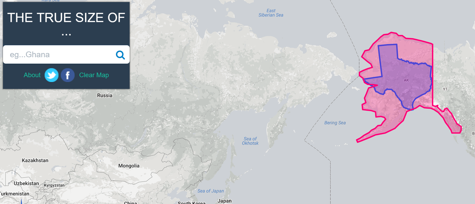
Over the weekend Open Culture featured one of my favorite websites to use in geography classes. That website is called The True Size Of… and it lets you quickly compare the size of two countries or two states within the United States. To compare two countries simply enter one into the search box then enter a second one into the search box. Both countries will be highlighted for you. You can then drag and drop one onto the other to see a size comparison. The same process can be done with U.S. states.
If It Were My Home is a neat site that provides comparisons of countries. If It Were My Home will show you a comparison of geographic size of your country with that of another of your choosing. Beyond the size comparison, If It Were My Home shows you comparisons of twelve health and economics statistics about life in different countries. To view the comparisons just select two countries from the lists and click compare.
Overlap Maps is a free service that can be used to quickly compare the size of countries, states, provinces, and some bodies of water. To create a visual comparison of two countries select one country from the “overlap this” menu and select one country from the “onto this” menu. The comparisons you make are displayed on a map. You can make comparisons from different categories. For example, you can overlap Lake Erie onto New Hampshire.


